


Surface Temperature Map using satellite data
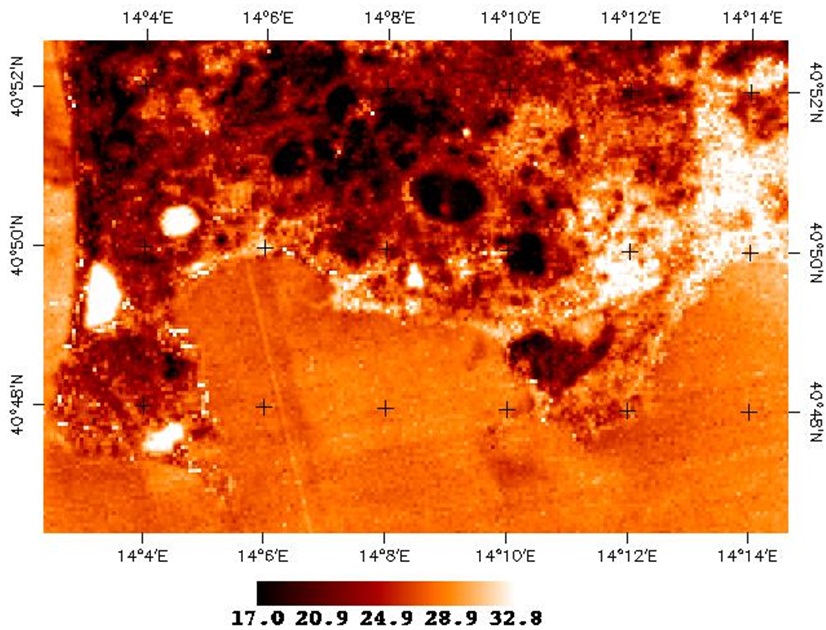
The Surface Temperature Map tool aims to produce surface temperature maps using optical satellite data having thermal bands (Landsat 8-9). The EO data is atmospherically corrected. The output is a GeoTIFF file with a spatial resolution of 30 meters.